Macintyre River floodplain consultation update
We acknowledge hydrology and flooding are key concerns for communities along the North Star to NSW/Queensland Border alignment, and extensive consultation on the Macintyre River floodplain model development has taken place at each stage of the project.
August 27, 2020
Earlier this month, the project team updated interested community members on the process used to develop the Macintyre River floodplain model and explained how community feedback has been incorporated into the model. The team outlined the steps involved in developing the proposed reference design and how the model was a key design tool in testing and validating potential impacts of the proposed alignment.
Community members can see information about the development of the project’s reference design, Macintyre River floodplain model and associated consultation in the project’s Environmental Impact Statement which has been placed on public exhibition by the Department of Planning and Environment (DPE). Additional feedback can be provided to DPE by making a submission.
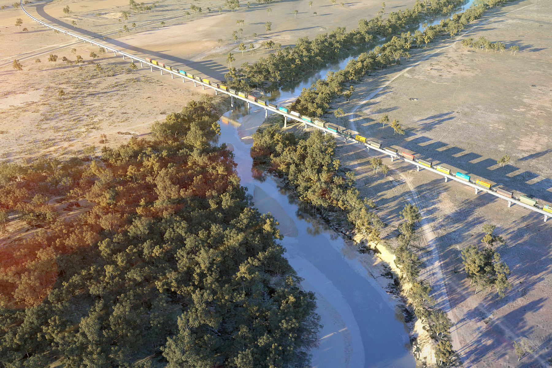
Don’t forget to check out the latest North Star to NSW/Queensland Border project fly-over for a bird’s eye view of the project’s reference design. This fly-over includes the proposed rail alignment, proposed Macintyre floodplain crossing solution, public road rail crossings, bridge structures, cuttings and embankments.