Status
Project Stage
- 1
- 2
- 3 Procurement
- 4
- 5
- 6
We engage suppliers to help us deliver the project. We commence land access and property acquisition negotiations (subject to government approvals), develop procurement documentation and get the project ready to…
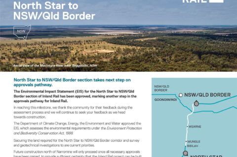
Learn moreThe Environmental Impact Statement (EIS) for the North Star to New South Wales/Queensland Border section of Inland Rail has been approved, marking another step in the approvals pathway for Inland Rail.
The Department of Climate Change, Energy, the Environment and Water approved the EIS, which assesses the environmental requirements under the Environment Protection and Biodiversity Conservation Act, 1999.
The New South Wales Department of Planning and Environment (DPE) provided conditional approval in February 2023.
The approvals include strict conditions to manage and report on outcomes for matters of national environmental significance and the environment.
Next steps
Activities to secure the land required for the North Star to New South Wales/Queensland Border corridor and inform the design of the project are continuing, including land and geotechnical surveys.
We will continue undertaking low impact works along the NS2B alignment which include identifying utilities, survey, cultural heritage, and geotechnical surveys to better understand ground conditions.
Keeping you informed about the project’s design, development and proposed impacts to your property is important to us. We remain committed to working with the community to ensure the best outcome for the region.
Project overview
The North Star to NSW/Queensland Border (NS2B) project consists of upgrading approximately 27km of non-operational rail corridor and constructing 12km of new track. This includes approximately 30km in NSW and 9km in Queensland.
While the NSW section of the Project has received State approval, the 9km section of rail in Queensland will be considered as part of the environmental approvals for the NSW/Queensland Border to Gowrie.
Crossing the Macintyre floodplain
An important part of our work on this project is developing technical and engineering options for crossing the Macintyre River floodplain.
We developed a detailed flood model of the Macintyre floodplain catchment area, using data from many different sources. It is based on existing flood modelling information which was developed by the Biodiversity, Conservation and Science Directorate of DPE. The model also considers predicted future impacts from climate change.
Since August 2018, our project team has met with landowners whose properties were surveyed for historic flood markers to validate the Macintyre flood model. Feedback has generally been that it reflects existing flood behaviour, however we will continue to review the model as we progress.
Hydrology-related submissions received during the project’s EIS exhibition requested additional modelling, including impacts for the 1976 flood event. We have worked collaboratively with DPE to address this via a hydrology working group.
Our flood model has been compared to the existing Border Rivers Floodplain Management Plan model and updated to incorporate feedback from an independent review facilitated by Goondiwindi Regional Council, the latest LiDAR data and the Australian Rainfall and Runoff (ARR) 2019 guiding principles.
The latest calibration is more robust than previous model calibrations, and the hydraulic model incorporates 2019 LiDAR data for a more accurate representation of the current ground conditions.
We will continue to work with directly affected landowners, local flood specialists, government and the broader community to incorporate their feedback and input into the reference design.

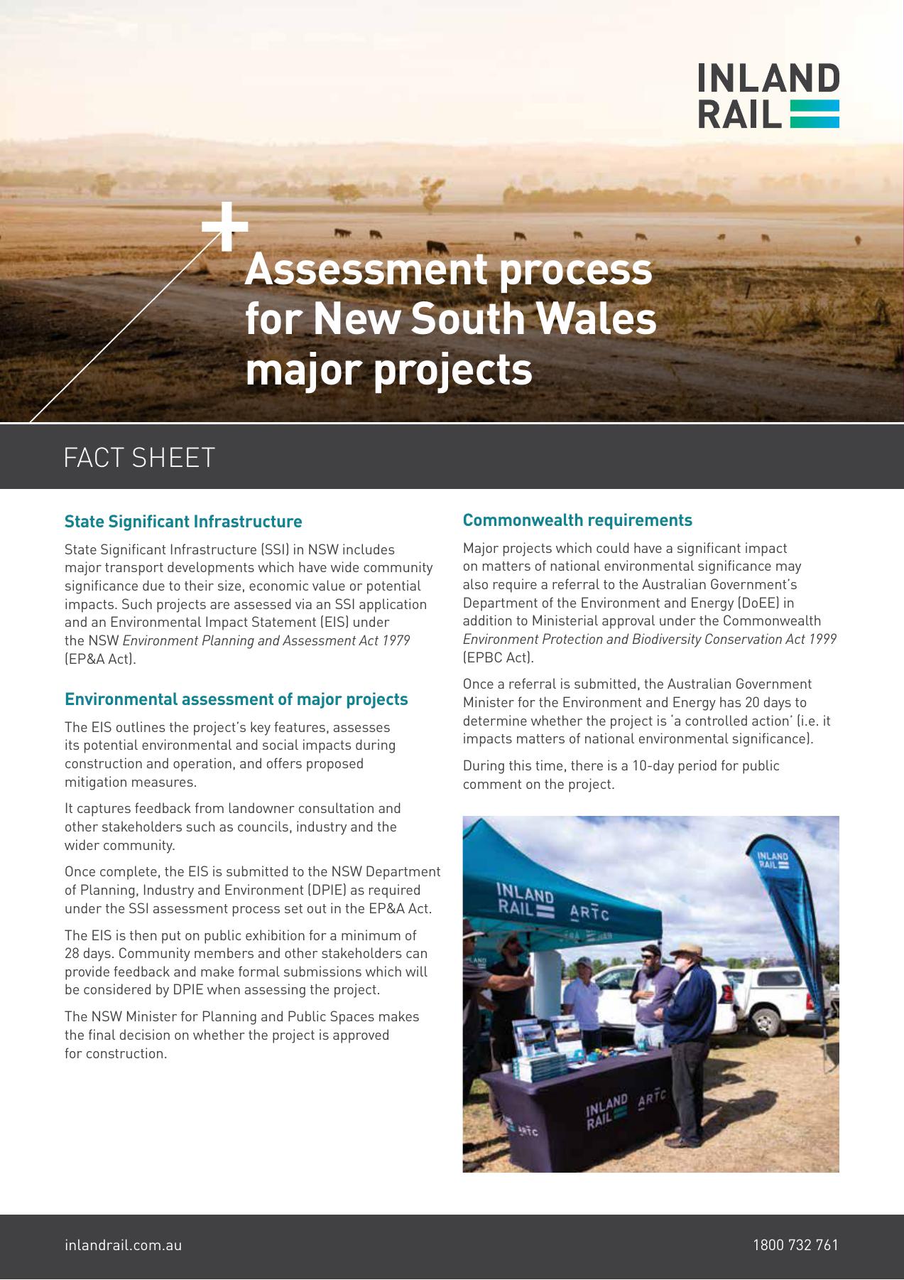
Assessment process for New South Wales major projects
This fact sheet outlines the key steps in assessing Inland Rail major projects in New South Wales.