Requesting 2022 flood images
Following the rain and flooding events this year, ARTC is undertaking studies to understand how properties were impacted and incorporate any new information such as new peak flow levels into project designs.
June 15, 2022
We request that you share with us any photos and videos that you may have taken during the February-March floods that show the highest levels reached or the peak flow debris mark.
To upload the photos, you can either:
- use ARTC’s secure file sharing portal. Please type in your email address, ‘Flooding images’ in the ‘Subject’ field, attach the images and videos using the green ‘Add Files’ button and send; or
- based on your location, add a comment on the interactive map for the G2H project or H2C project or C2K project using the ‘Flooding comment’ marker. Add your details and attach your photos.
You can also call us on 1800 732 761 and speak to Corey Doran or Kylie Wendell to provide the same details or ask any questions you have.
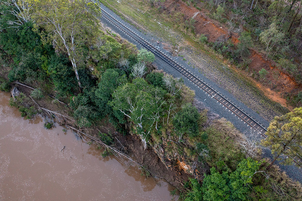
Please note that ARTC commissioned aerial drone photography to collect images and video footage of the rain event in May however due to road closures and unsafe conditions, the drone operators were able to mobilise only after the roads were opened.
Images and video footage we have collected show flood debris markers and swollen creeks. We would like to supplement this footage with any that you may have taken during the peak of the February-March floods.
IMAGE: An aerial image of the Lockyer Creek near Airforce Road, Helidon following the May 2022 flood.