Two-year survey ensures the accuracy of Inland Rail
After two years Inland Rail has completed surveying and modelling of nearly 233,000 hectares of land – equivalent to the size of the Australian Capital Territory - to upgrade Queensland’s spatial cadastre as a crucial part of delivering the Inland Rail project.
September 4, 2023

The spatial cadastre is a digital representation of every parcel of land on the Inland Rail route in Queensland and is used to accurately identify the location of the new Inland Rail line and manage land use and ownership along the route.
Working with the Queensland Department of Resources (DoR) Inland Rail has updated more than 7699 land parcels including 601 easements covering a total of 232,811 hectares.
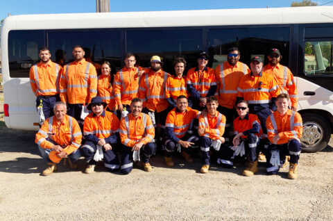
The Inland Rail team conducted extensive ground-based surveys and used field data to develop detailed and accurate reference files to further enhance and update the accuracy of the spatial cadastre.
An additional five new Continually Operating Reference Stations (CORS) have also been installed along the alignment to enhance coverage between the Queensland/New South Wales border and Toowoomba. This work was done in collaboration with Geoscience Australia as part of the Positioning Australia initiative.
Inland Rail Survey Program Manager Mark Pierce said:
‘Updating the Queensland spatial cadastre is an important step in ensuring accurate information is available for use by the Inland Rail when engaging with key stakeholders.
‘These new data sets will be used to accurately identify the location of the new rail line and manage land use and ownership along the route.
‘More than 450 new permanent survey marks were added to the survey control register as part of the control network being installed to support the design, construction, and ongoing maintenance of Inland Rail.
‘These Survey Control marks are now part of Queensland’s geodetic network and positioning infrastructure, and support ARTC’s commitment to enhancing regional infrastructure and providing legacy community benefits for future surveying, engineering, road building and mapping purposes.
‘This is a significant achievement for the DoR and ARTC as it marks another milestone in the development of this important project.’
Department of Resources Cadastral, Geodetic & Permit Data Manager Gordon Szczepina said:
‘The primary focus for the Department is the accuracy of the information for future land management and planning.
‘The accuracy of the spatial cadastre is a critical aspect of any project, especially one of this size and importance.
‘Our team has been working closely with Inland Rail for the past two years to upgrade the spatial accuracy of the Inland Rail corridor to 0.1-1m for more than 300km from the Queensland/New South Wales border to Kagaru.
‘We have taken their data and assessed it against high-resolution imagery to upgrade the current land parcels to represent a more accurate spatial cadastral fabric.
‘Ultimately, upgrading the accuracy of the spatial cadastre for the Inland Rail project is a vital aspect of ensuring the project is delivered in a timely and efficient manner with minimal impacts on the environment and local communities.
‘The updating of the spatial cadastre and enhancement of the survey control register are great examples of strong collaboration between ARTC and the Department.’


